Six Historic Forts in Portland You Can Reach By Foot or Kayak
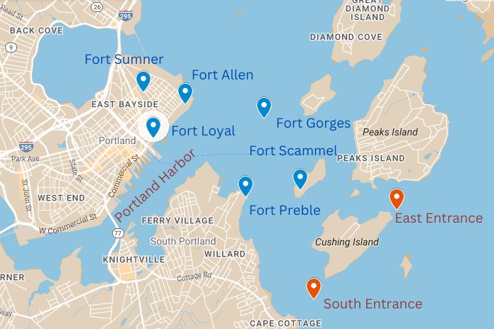
Forts of Casco Bay: Part 1 – European Settlement to the Civil War
We’ll follow up this post soon with another featuring the fortifications surrounding Portland harbor that were built after the Civil War.
The sites of Portland’s earliest defensive structures are all a short walk or paddle from Portland Paddle’s site by the East End Beach. Some of these structures are still intact, and can even be entered and explored, while others are marked only by signs or memorials. Either way, visiting these sites offers a fascinating window into the past, whether you are paddling to an island fort with one of our guides or viewing the grounds of 17th and 18th-century battles as you walk the waterfront trail that runs between our site and the Old Port.
Why Does Portland Have So Many Forts?
Portland grew into a major port and railway hub during the 1800s, but early attempts by Europeans to live in the region ended in disastrous warfare. Before the first European house was built in Casco Bay in 1623 on House Island, it was the Wabenaki people who paddled the waters of Casco Bay and walked the shores of Machigone, the strip of land now known as the Portland peninsula.
European colonists first came to the region primarily in search of fish, timber, furs and other commodities to sell in Europe. But from the earliest days of their presence, the territory that is now Portland was hotly contested between the indigenous Wabanaki, colonists from France and colonists from England. With its well-sheltered harbor, hilly peninsula, and ample food sources, the Portland area was a defensible and well-resourced site for settlement. This led to bloody conflict, and the construction of Fort Loyal, the first fort featured below.
Portland burned to the ground three different times as a result of territorial conflicts in the region (a fourth time, known as the “great fire”, was caused by an accident in the port’s warehouse district in 1866). As the city became a well-established port, and a hub for shipbuilding and other industry, much larger and stronger forts were built to ensure the city would not be as vulnerable to attack as it had been in its early years. Many of these iconic structures, made of granite, steel and concrete, remain visible today.
Munjoy Hill and the East End – The Early Settlement Period
The oldest fortifications in Portland were built on the north and east ends of the city in the neighborhood today known as Munjoy Hill, on the tip of the peninsula, which the Wabanaki referred to as Machigone or Məkíhkanək. Early English settlers called both the town and the surrounding area Casco, and though the main town was concentrated on the eastern peninsula, individuals also built farms in parts of what are today Westbrook, Falmouth, Cape Elizabeth, South Portland, and many Casco Bay islands. None of the fortifications from this era are still standing, but you can still visit their locations, many of which are in public parks with plaques that memorialize them. (If you’d like to take a guided walking tour with a local expert to learn more about Portland’s history, consider our friends at Portland by the Foot, or hop on a bike with our friends at Summer Feet Cycles!)
Fort Loyal
The earliest fortification built in Portland, Fort Loyal was a wooden fort built by the British in 1678 and actively used through the Revolutionary War (though it was burned down and had to be rebuilt several times). At the time Fort Loyal was built the colonial settlement was known as Falmouth (present day Falmouth was at that time called New Casco). Fort Loyal was located at the foot of Munjoy Hill, approximately at the location of the Grand Trunk Railway Office building on the corner of India and Thames streets, where a plaque now memorializes it. The building is near the current day Ocean Gateway Terminal and Maine Narrow Gauge Railway. The first destruction of Fort Loyal in 1690 by French soldiers and their Wabanaki allies from what is today New Brunswick led to the near total removal of Europeans from present day Maine. By 1742 British settlers had returned to southern Maine in sufficient numbers to rebuild the town and fort, which was briefly called Falmouth Fort. Earthen fortifications were added in 1775 to prepare for the Revolutionary War, which were referred to as the lower battery.
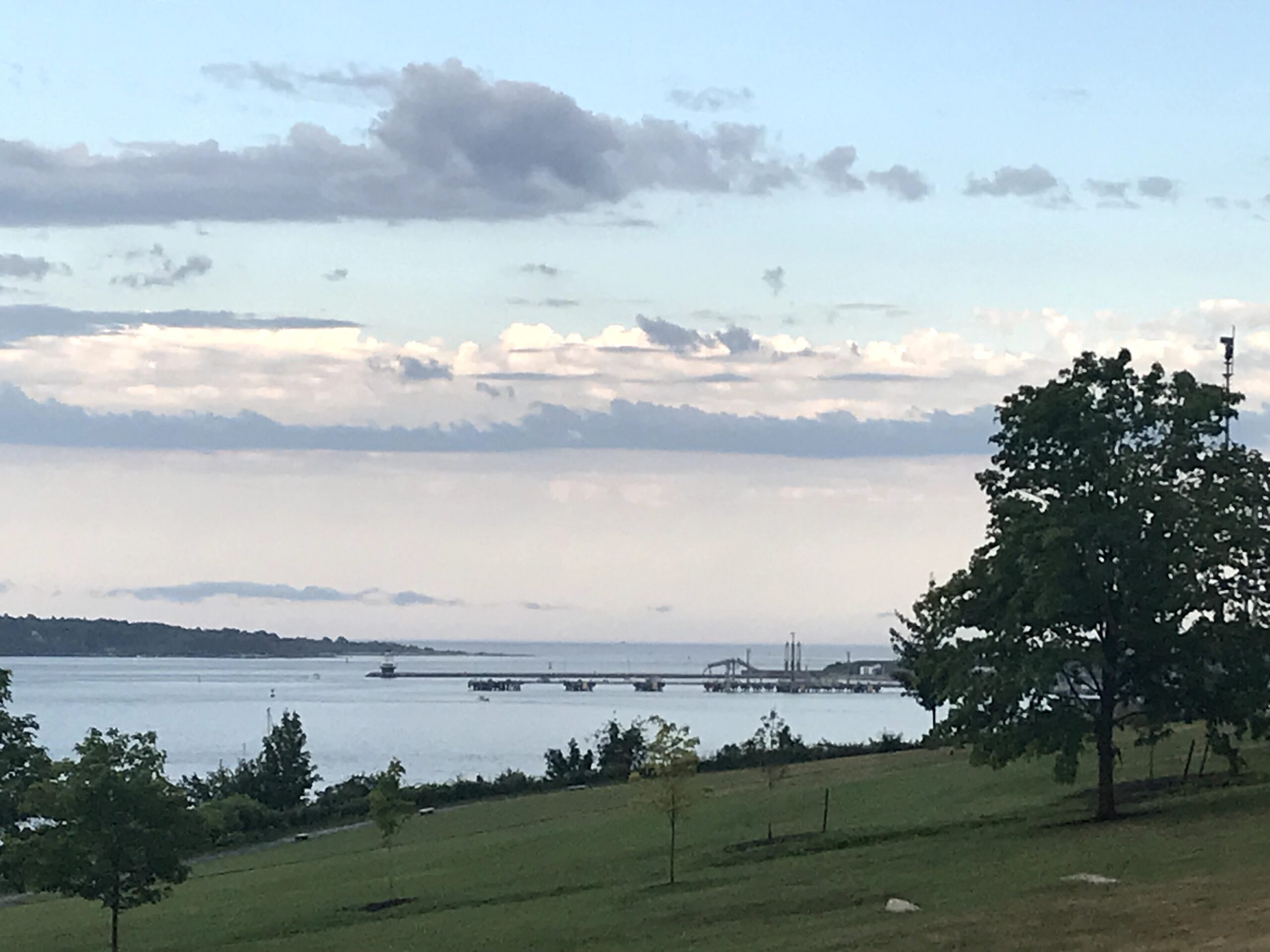
View from Fort Allen Park, Spring Point Light and Fort Preble can be seen in the distance
Fort Allen
Fort Allen was built during the Revolutionary War, with commanding views of Portland Harbor and Casco Bay from atop Munjoy Hill. The design was upgraded during the war of 1812, specifically in response to the invasion of Downeast Maine by British Canada, at which time it was incorporated into nearby Fort Sumner’s defenses. Who exactly the fort is named for is a matter of debate. It may have been named for Vermont Revolutionary War hero Ethan Allen, or named during its rebuilding for the naval commander William Henry Allen. The fort was converted into a public park in the 1890s under the leadership of Mayor James P. Baxter, one of several parks in the city which he and his son, Governor Percival P. Baxter, would help to create. Today it hosts a bandstand, and memorials related to American naval history, including a gun from the USS Maine, the foremast of the USS Portland, and a memorial to those who lost their lives in the Arctic Campaign of World War II.
Take a walk through the Munjoy Hill Neighborhood after visitng East End Beach!
Fort Sumner
Fort Sumner was built in 1794 as part of the first federal coast defense system by the young U.S. government. Now the site of Fort Sumner Park, also known as Standpipe Park, which overlooks Back Cove. At the time the fort was built it would also have had views to Casco Bay, though today there are too many buildings on Munjoy Hill. Though Fort Sumner was reduced in importance by the construction of Prebel and Scammell in 1808 as part of the second federal coast defense system, local citizens took it upon themselves to upgrade the fort in 1814 due to heightened concerns that Portland would come under attack by British troops, following the capture of Eastport and Castine. After the fort was abandoned by the military in the 1820s it was briefly turned into a gymnasium, one of the first to be opened in the United States.
Portland Harbor Defenses – Wars with the British and the Confederacy
Portland Harbor’s three primary 1800s-era defensive fortifications are all still standing, and are open to the public. Together these forts guarded both the east and south entrances to the harbor, and were positioned so that an attacking ship would be caught between the crossfire of the forts as it entered.
Fort Gorges
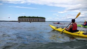
Kayakers approach Fort Gorges
One of the most iconic landmarks around Portland Harbor, Fort Gorges sits by itself on a ledge of rock in the middle of Casco Bay. Fort Gorges was built as part of the third wave of federal coastal defenses, following the war of 1812. However, funding wasn’t secured until shortly before the Civil War. While construction was underway a naval battle took place in Portland Harbor, though the unfinished and ungarrisoned fort was unable to take part. Though the fort was completed before the end of the war, its original design was already deemed obsolete. Several upgrades were made over the next few years before it was eventually decommissioned. Later the open area at the center of Fort Gorges was converted into a mine and ammunition storage facility, part of Portland harbor’s anti-submarine defenses during World War II. Today the fort is a public park, owned by the city and supported by the Friends of Fort Gorges, accessible only by boat. Portland Paddle offers kayak tours to the fort multiple times a day, where visitors are treated to the best skyline view in all of Portland from atop its walls, and can learn even more about its construction and rich history.
Fort Scammel
Fort Scammel, sitting on private House Island, was built in 1808, though most of the surviving structure dates from a round of upgrades conducted from 1850 to 1876. Though the fort is privately owned, public access is available via kayak tour, motorboat tour, or by booking one of several yurts for an overnight stay. Following the Civil War the fort saw little use or upgrades, though it was part of the anti-submarine defenses and ammunition storage system in Portland Harbor during the World Wars.
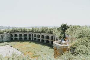
A glimpse of Fort Gorges’ interior parade ground and cannon gallery from the top of the walls
